Home
What is a geopark?
The geopark is an area that includes the interesting localities from the perspective of geological sciences. These localities are developed in cooperation with local communities and governmental and private organizations in order to support the growth of regional infrastructure, number of visitors and level of education. Besides the geological localities, the geopark includes cultural, environmental, archeological and historic sights. Except for the specially protected areas, the human activities in the geopark are not affected and the sustainable development of the region is encouraged. The idea of geopark connects the promotion of geological heritage with regional development. Moreover, the geopark acquaints the visitors with geological processes and with the significance of natural resources and their utilization in economic and cultural history of the area.
Železné hory Geopark
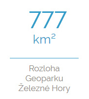
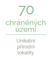
The Iron Mountains Geopark covers the area of 777,5 km2. The main part is situated in the Pardubice Region, the area around Ždírec nad Doubravou and Chotěboř steps in the Vysočina Region. One third of the total area comprises of the Protected Landscape Area Železné hory. Besides the Protected Landscape Area Železné hory, there are other specially protected areas.
The area of the Iron Mountains Geopark provides natural resources, cultural and historical sights, unique museums and numerous possibilities for sport and recreation. Besides mentioned facilities, the Iron Mountains Geopark is a perfect place for hiking and cycling. The whole area of the geopark is interweaved with dense net of touristic tracks and bike trails. In addition, the geopark offers tens of kilometers of equestrian trails and cross-country skiing trails. All the facilities are supplemented with localities of geological significance.
From a geologist´s point of view, the area of the Iron Mountains is as diverse as a comprehensive textbook of geology. During its 600-million-year history, a large number of geological phenomena appeared and nowadays we can explore them in only two or three days. In order to see such diverse geological localities, you would have to travel thousands of kilometers all around Europe, however in the Iron Mountains, you can visit the whole history of the Earth in a very short time period on a very small area. In the Iron Mountains, we can solve the geological puzzle very quickly and comfortably.
og The Iron
Mountains
Geopark
exceptional
locations
natural
locations
with the Geology
theme
bicycle path
in CR
