Ongoing projects
Geopark – science, research
Ongoing projects
The Danube Transnational Programme
2014 – 2020
Acronym: Danube GeoTour
Programme: Interreg Danube Transnational Programme 2014-2020
Reference DTP1-226-2.2
The programme focuses on: PA2, Environment and culture responsible Danube region
Developer: Idrija Heritage Centre- Idrija Geopark (SLO)
Partners:
Balaton-felvidéki National Park Directorate (H)
Styrian Eisenwurzen (A)
Public institution »Nature Park Papuk« (CRO)
ARGE Geopark Karavanks (A/SLO)
Institute of the Republic of Slovenia for Nature Conservation (SLO)
Bakony & Balaton Regional Tourism Nonprofit Ltd. (H)
Iron Mountains (CZ)
University of Bucharest (RO)
University of Presov (SL)
Public Enterprise National Park Djerdap (SRB)
In addition, there are 3 strategic consultants involved in the project who support the partners in providing high quality work:
Humanpolis ltd / Rokua Geopark (F)
Naturtejo – Tourism Company (P)
Global Geoparks Network (FR)
Project period: 1.2017- 30.6.2019
Budget in Euro:
Total: 1,666,362.5
ERDF Contribution: 1,328,063.36
IPA Contribution: 88,344.75
ENI Contribution: 0
Further information at: www.interreg-danube.eu
The main project objectives are to improve management capacities and strategies, develop practical solutions for the activation of geodiversity/geoheritage and seize positive market trends to develop sustainable tourism in 8 Geoparks in the Danube region.
Implementing an integrative approach, the project shall address four common challenges:
- avoid or handle negative effects and environmental impacts of new forms of Geopark tourism,
- seize the potential of the brand Geopark and its values for socio-economic development while inspiring local residents and small businesses to develop new, sustainable and innovative geoproducts along the defined Danube GeoTour,
- present geodiversity in a comprehensive, understandable and attractive way,
- use the synergies of joint learning and marketing for greater awareness of Geoparks in the Danube region,
- the project shall result in a joint Danube GeoTour which is based on the unique natural, cultural and geographical heritage of the Danube region and comprises a variety of itineraries as well as a set of innovative geoproducts and geointerpretation sites.
Work packages:
WP1: Project Management
WP2: Communication Activities
WP3: Geopark with(out) limits
WP4: Distinctive GeoProducts
WP5: GeoInterpretation
WP6: GeoPartnership & Marketing
The 3 subgoals of the project:
- A first step is to establish a balance between the preservation of geological sights and geotourism development in Geoparks. This involves defining and analysing common opportunities and constraints of sustainable geotourism development. It is also essential to form a set of measures for managing the increased pressure, negative variations and new forms of tourism in Geoparks such as the collection of fossils, adrenalin parks, etc.
- Developing, demonstrating and evaluating innovative geoproducts and analysing the geosites of 8 participating Geoparks shall be a pillar of a joint “Danube GeoTour”. Collaborating closely with partners, visitors and local inhabitants, the project shall create, test and implement a set of specialized and authentic geoproducts (geoCulture and geoOutdoor) along with modern interpretation methods and techniques. The aim is to improve touristic offers and attract new visitors. By the inclusion gamification methods, locals are to be motivated and integrated into the process by group-work approaches or idea contests. Thus, interested local people get involved in the learning process and are asked to help develop the geoproducts. Finally, the Danube Geoparks are to be bolstered in terms of visibility and identity both nationally and internationally. Cooperating in GeoTourism will benefit the local population socio-economically.
- In this project, transnational partnerships shall be the foundation of joint marketing activities. The joint Danube GeoTour will get a platform using innovative digital concepts, creative marketing and collaboration tools.During the project, the partners have to manage a variety of tasks. The Slovenian lead partner Idrija Geopark will establish a new visitor centre. The focus will be on the local mercury mine which has an important geological legacy. The Hungarian Bakony-Balaton Geopark has two objectives: renovating the existing visitor centre in Hegyestű and updating the “Volcanism” theme trails. The Austrian Styrian Eisenwurzen Nature & Geopark will set up three modern visitor information points in three different places, which will focus on the region’s abundance of water and thereby represent a further link to the Danube GeoTour. The Croatian Papuk Geopark is going to install an innovative visitor information board in Zvečevo. This serves as a means to learn about geology, metamorphic rocks and processes related to them. The Serbian Djerdap National Park, as a potential geopark, will create a venue for knowledge transfer in Tekija. The village is located directly on the Danube near the Iron Gates known as the Danube water gap.
Project co-financed by European Union funds (ERDF, IPA)
www.interreg-danube.eu

Basic geological mapping of the Czech Republic 1: 25 000
Basic geological mapping of the Iron Mountains National Geopark 2014-2018
In cooperation with the Czech Geological Survey basic geological maps of the following map leaves have incurred in the period 2014-2018 – Chvaletice 13-411, 13-412 Přelouč, 13-414 Ronov nad Doubravou, Chrudim 13-423, 13-432 Vilemov and 13-441 Nasavrky. At the same time will be made up special maps showing the situation of geo- and exodynamics, hydrogeological, and geological environment and occurrence of mineral deposits.
The objective of the geological work is to evaluate the geological structure of the west part of the Iron Mountains National Geopark on the basis of new geological mapping in scale. 1: 25 000. In this territory regional geological units are represented: moldanubikum, Kutna Hora Crystalline, ohebské Crystalline, železnohorské crystalline, Železnohorský plutonic complex, the younger Paleozoic of furrows (jihlavská brázda – so called Kraskov perm), Czech Cretaceous Basin (Chrudimská křída and Křída Dlouhé meze), Cenozoic sediments (quaternary accumulation).
Part of the geological work is to evaluate the territory by geophysical, geochemical, hydrogeological, geological aspects and also in terms of deposits and geo-factors of the environment. Geologically significant sites with regard to the needs of the National Geopark Iron Mountain will be also identified and described.
Železné hory – a geologically significant region
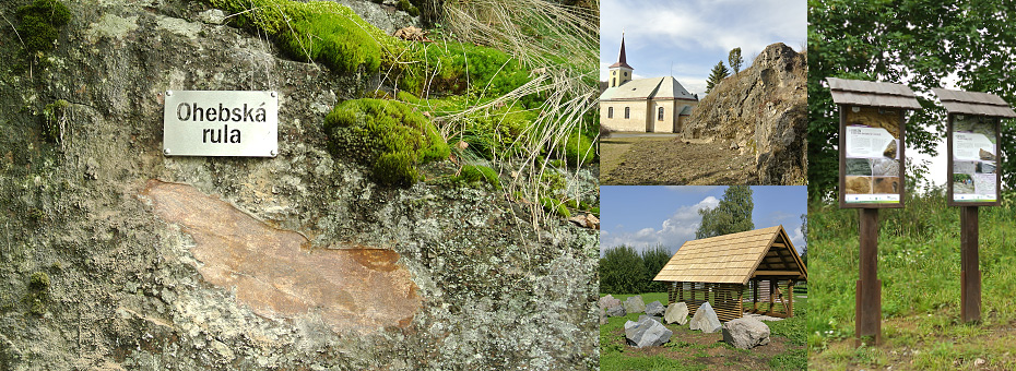
Nově spuštěný projekt Železné hory – geologicky významná oblast dává možnost komplexního seznámení návštěvníků tohoto regionu s ohledem na relativně malé území Železných hor. Bohatost a pestrost přírodních jevů je jedinečná a mimořádně zajímavá. Naučné tabule vznikly v rámci projektu „Železné hory- geologicky významná oblast“ spolufinancovaného z prostředků Státního fondu životního prostředí ČR a AOPK ČR. Projekt je strukturován tak, aby bylo možné v pět informačních bezobslužných stanovištích s tématickou náplní PROTEROZOIKUM, PALEOZOIKUM, HLUBINNÉ VYVŘELINY, MEZOZOIKUM A HYDROGEOLOGIE získat obecné informace o daném tématu s odkazy na konkrétní blízké lokality, na kterých budou umístěny informační panely. Tyto panely budou osazeny na 34 lokalitách. Některé z vybraných lokalit jsou ojedinělé v rámci České republiky. Na informačních panelech bude konkrétní jev na té které lokalitě blíže rozveden. U celkem pěti informačních bezobslužných stanovišť bude v plenéru umístěna venkovní expozice tvořená reprezentativními ukázkami horninových bloků s příslušným návěštím – informací. Součástí projektu je rekonstrukce naučné stezky Údolí Doubravy, při které budou vybudovány analogické informační prvky. V rámci venkovní expozice horninových bloků bude u každého z nich umístěna příslušná informace ve formě návěští se stručným komentářem o petrologické, geologické a eventuálně technologické či hydrogeologické charakteristice. Tam, kde to bude technologicky možné, bude na horninovém bloku provedeno vyleštění plochy; důvodem je „vizualizace“ minerální stavby, struktury a textury té které horninové ukázky.
V rámci projektu budou vypracovány metodiky, studie, propagační a informační materiály, které budou směřovat ke zvýšení informovanosti návštěvníků tohoto regionu. Součástí tohoto projektu budou i odborné semináře a exkurze, se kterými Vodní zdroje Chrudim, spol. s r. o., a CHKO Železné hory mají dlouholeté zkušenosti. Doprovodem těchto seminářů bude i publikační činnost, výsledky těchto prací budou prezentovány v odborných a populárně naučných časopisech. Ve spolupráci s CHKO Železné hory a s vysokými školami je možné zadat výzvu diplomantům o zpracování bakalářských či magisterských prací z oboru geologie, petrologie či sociologie.

Kameny a voda
Projekt Kameny a voda je zaměřen na rozvoj kompetencí žáků ve vzdělávání pro udržitelný rozvoj a zlepšování podmínek pro výuku technických, přírodovědných borů a řemesel. Projekt reaguje na potřebu osvojení si teoreticky získaných informací v praxi a na schopnost tyto informace předávat dál. Zvýrazňována je především zpětná vazba na využití praktických poznatků i v ostatních vzdělávacích oborech. Cílovou skupinou jsou žáci a studenti, kteří podstoupí výuku v rámci povinné školní docházky.
Vzdělávání žáků a studentů v geovědách, kde dochází k cílenému propojení teoretických a praktických znalostí s možností improvizace na konkrétní témata v konkrétním regionu je základem pro úspěšné uplatnění v další struktuře vzdělávání. Rozšiřují se tak možnosti uplatnění se nejen na školách gymnaziálního směru, ale i na školách směru technického (např. obory stavební, vodohospodářské, sanační apod.).
Výstupem projektu bude ucelená hodnotící a výuková struktura použitelná pro další školy v regionu, dále exkurzní průvodci, tematická geologická expozice na ZŠ Maleč a venkovní učebny.
Projekt je financován z Operačního programu Vzdělávání pro konkurenceschopnost.


